A Neolithic Fishing Lodge at Cham-Eslen (Canton of Zug, Switzerland)?

Renata Huber sent this attached  poster about a proposed neolithic fishing lodge at Cham-Eslen (Canton of Zug, Switzerland), which they presented at the international conference: Culture, Climate and Environment Interactions at the Prehistoric Wetland Sites conference 11-14 June 2014 at Bern, Switzerland: https://www.academia.edu/7327351/Renata_Huber_Andr%C3%A9_Rehazek_2014_A_Neolithic_Fishing_Lodge_at_Cham-Eslen_Canton_of_Zug_Switzerland  Interesting bound net sinker cobbles and some net fragments have been found.  Twenty net weights were found with lime bast still attached.  Two or even three (?) log boats were found next to the single house feature, with one salvaged in 2013.

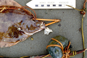
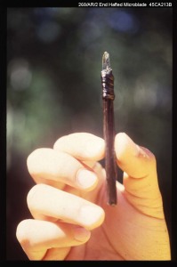
Similar bound, plain cobble, anchor stones are found in wet sites along the Northwest Coast, such as those wrapped with cherry bark from the Hoko River site.  Also a spruce twig net and end hafted and bound quartz crystal microblades were recovered.  See these artifacts in the Hoko River digital image archive as discussed under NewsWARP Announcements:  Hoko River Archaeological Site Complex Digital Archive

Renata recently sent a paper on the site in German.  This composite tool with an elaborately bound handle was found at the site (pictured here).  The paper can be obtained here:  Cham-Eslen (Kanton Zug, Schweiz):ein jungneolithisches Haus mit (fast) allem Drum und Dran?Taphonomische Aspekte einer Seeufersiedlung .

Please submit reports in any language on PDFs or .DOCs.  Here is an English summary of the paper too:

Taphonomic analyses carried out on wetland settlements illustrate just how much evidence is missing from dryland settlements. Moreover, various opportunities exist in the areas of macroscopic and even more so in microscopic analysis. These advantages are outlined using the lakeside settlement of Cham-Eslen as an example. The settlement is suitable in many ways for taphonomic examinations: the site consists of a single house, which was situated on an island (today submerged in the lake) and according to dendrochronological dates was probably inhabited for approximately 10 years. It has yielded well-preserved and unusual finds. From a macroscopic point of view, the distribution patterns of the heavier finds are used to ascertain what might be considered in situ (in other words, still located where they were originally deposited). Micromorphology is used to ascertain the state of preservation. Different areas with various states of preservation were identified in the samples by applying several criteria. These have provided evidence for the absence of limnic elements and bioturbation traces, as well as the presence of ash and evidence of trampling. A number of deeper cores served to investigate whether the site is, in fact, an island or whether it is the product of a process of erosion. The results revealed that the house in Cham-Eslen was built on a dry island, the centre of which was not affected by flooding during its occupation. Therefore, we may assume that the features in this area have survived in situ. However, the outer areas of the house do, in fact, show traces of regular soil disturbances.
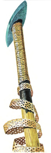
Translation: Sandy Hämmerle, Galway, IrelandComposite tool with elaborately wrapped handle from Cham-Eslen

New Taphonomic Research in Archaeological Wetland Deposits: The Bone Midden of Zug-Riedmatt (Central Switzerland)

Eda Gross sent this attached  poster about the trans-disciplinary studies about the neolithic wetland-site of Zu-Riedmatt, which they presented at the international conference: Culture, Climate and Environment Interactions at the Prehistoric Wetland Sites conference 11-14 June 2014 at Bern, Switzerland:  www.academia.edu/8098246/S.Billerbeck_H._Hüster_Plogmann_K.Ismail-Meyer_B._Steiner_Ö.Akeret_E._Eckmeyer_A._Heitz-Weniger_E._Gross_S._Jacomet_Ph.Rentzel_G.F._Schaeren_J.Schibler_New_taphonomic_research_in_archaeological_wetland_deposits._the_bone_midden_of_Zug.Riedmatt_Central_Switzerland_

The site, dating about 3200-3100 cal. BC, is a wetland site in the Lorze River delta at the shoreline of Lake Zug, with abundant subsistence foraging opportunities and lithic materials for stone axe production.  See their trans-disciplinary results using 110 profile columns, 607 surface bulk samples, 1354 wood samples, 7432 bones, and 12,753 artifacts in this beautifully composed and narrated poster.

This UNESCO-World Heritage Site is described in the web site Prehistoric Pile Dwellings around the Alps (http://www.palafittes.org/en/unesco-world-heritage/sites-switzerland/index.html)

CH-ZG-05, Zug–Riedmatt: The layers at Zug–Riedmatt are very well preserved, 60–140 cm thick and have also yielded a large amount of organic finds. Ongoing research in a very small test-trench has revealed an extraordinary potential especially for microstratigraphic data with regard to the formation of the cultural layers. The site provides the best preserved reference material of a former phase of Horgen Culture (around 3200 BC) in Central Switzerland.  logo_palafittes_en

WARP Session at XIX INQUA 2015 NAGOYA, JAPAN 27 July-2 August, 2015

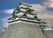
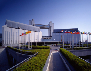
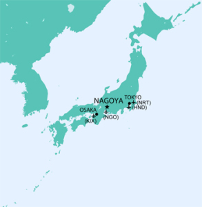
nagoyacastlOnce every four years, Quaternary researchers from all over the world meet at the INQUA Congress to exchange the latest research results and develop agendas for the years to come. In 2015 a WARP Session is planned lead by Tony Brown, University of Southampton, titled:  Wetland archaeology and environmental change (http://convention.jtbcom.co.jp/inqua2015/session/h04.html).   The Congress will take place in Nagoya, Japan. The Nagoya Congress Center (NCC), the venue, is the largest conference facility in central Japan. Nagoya is located between Tokyo and Osaka, connected to both cities by super-express trains (Shinkansen) departing every ten minutes. Kyoto and Nara, former capitals, Lake Biwa, and the Japan Alps are located within easy access of Nagoya.

The WARP Session is described as follows:

Archaeological sites in wetlands and lake environments have revealed remarkable aspects of the human past that are out of reach of typical dry-land archaeology. This includes the perishable components of material culture that were far more important in early prehistory prior to the use of metals or indeed today. Whilst the excavation of wetland sites started in NW Europe, especially on the famous lake villages of Switzerland, it has now expanded worldwide to southern Europe, North America, and even Africa. One of the geographical areas of greatest potential is SE Asia including Japan, where excavations of Jomon sites have revealed both remarkable, but also important, details of past human lives and their relationship to changing environmental conditions. Because of the exceptional importance of environmental data to wetland archaeology its study has always been closely related to Quaternary studies and this session will exploit this Quaternary-Archaeology synergy. In this session, jointly convened by European and Japanese environmental archaeologists we will address how studies of wetland sites (wetlands and lakes) can contribute to studies of Holocene hunter gatherer lifestyles including plant and animal husbandry, to the history of agriculture worldwide and the relative importance of environmental change at a variety of scales from the short-lived and local ‘events’ to global trends.

The Conveners are:

Tony Brown [University of Southampton]
Akira Matsui [Nara National Institute for Cultural Properties]
Fumio Ohe [Nara National Institute for Cultural Properties]
Masashi Maruyama [Nara National Institute for Cultural Properties]
Toshio Nakamura [Nagoya University]
Iwao Nishida [Saga city]
Nicki Whitehouse [University of Plymouth]

Hope to see you there.  Here’s the main INQUA web site:  http://inqua2015.jp/index.htm .  Here’s a picture of the Nagoya Conference Center and location in Japan.

NCC  japan

Welcome to the Hoko River Site Digital Image Archive

Hoko77 25.23

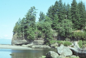
During the late 1970s and 1980s we excavated a 3,000 year old wet site and 900 year old Rockshelter at the mouth of the Hoko River, Washington State, USA. Even though much of the photographic recording was in color slides and black and white film, we undertook to scan over 3000 representative images from the work and this is indexed for both sites, including a way to virtually excavate in 5 cm levels in the Hoko Rockshelter. Though the first and second volume of the The Hoko River Archaeological Site Complex reports are available through Washington State University Press (1-800-354-7360), and entitled The Hoko River Archaeological Site Complex, the Wet/Dry Site (45CA213), 3,000 – 1,700 B.P. (1996) and The Rockshelter (45CA21), 1,000 – 100 B.P. we wanted to make this Hoko River DIGITAL IMAGE ARCHIVE available in NewsWARP. Please explore it at:  Hoko River Archaeological Site Complex Digital Archive .  May help in classes as an example of a virtual excavation of a shell midden. The software is a bit old, but at least we have more of the site documented in this manner. Any input appreciated.Fish Experiment reducedBVB00287

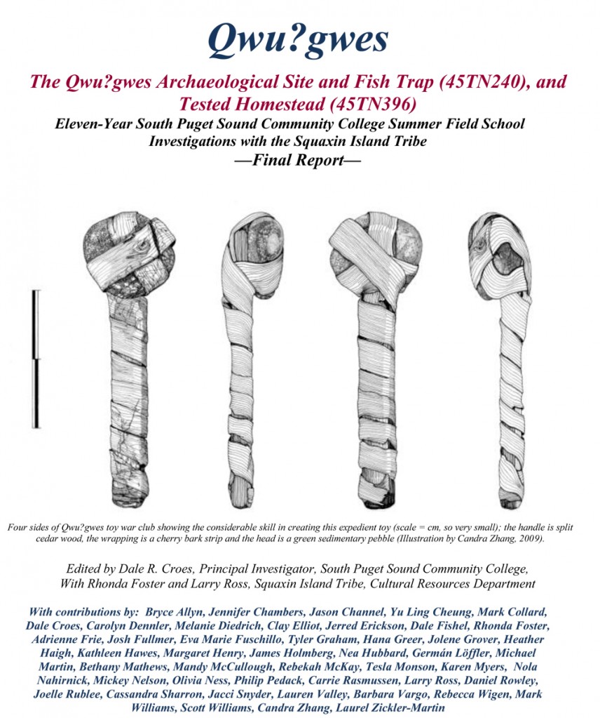
Qwu?gwes Archaeological Wet Site Final Report

This final Qwu?gwes wet site report has been accepted by the Washington State Department of Archaeology and Historic Preservation–if you would like to download a pdf go to:  Qwu?gwes Final Report with data Appendices
OR a two column version (1/2 size) with out the data Appendices:  Qwu?gwes Final Report in 2-column Polished Format
Qwu?gwes (45TN240) is located on Mud Bay at the southern end of Eld Inlet, Puget Sound, near Olympia, Washington. The site was named Qwu?gwes, a term in the indigenous Lushootseed language meaning a place to come together, share, and gather by the Squaxin Island Tribe in 2000 (Foster and Croes 2002). It describes a place where academic scientists and students and the cultural experts from the Squaxin Island Tribe strove to work in a cooperative partnership to better describe and explain the ancient history of this location. The ancient people and villages of this inlet were known as the “Squi-Aitl.”
The site consists of an area above the beach where food resources were processed, an intertidal shell midden, and an area where those gathering and processing would have temporarily lived. Also present nearby is a fish trap complex at the end of Orr Cove, northeast of the Qwu?gwes shell-midden (both considered 45TN240) and a homestead area to the southeast of Qwu?gwes that is associated with the original Donation Land Claim (45TN396).
Qwu?gwes is archaeologically significant because it (1) is the first substantial excavation of a site in all of south Puget Sound, (2) includes a waterlogged preserved section containing examples of wood and fiber artifacts in a major resource camp, and (3) contains a distinct record of shellfish and fisheries used at this camp.
From the beginning, the research and analyses for this multi-year field school project have been approached from two, equally important perspectives: (a) the scientific descriptive analyses and (b) the cultural explanatory analyses, both involving tribal representatives and archaeologists following the goal of an equal partnership through the 11+ years. These views are often complementary and provide a more comprehensive overview and place from which to offer joint interpretations of the ancient history of Qwu?gwes. The Qwu?gwes project has always been an educational training effort, not just a rescue excavation. Less than 35 cubic meters (2.3%) of the site have been excavated during the past 11 summer seasons of investigation. The 55, 1×1 meter units excavated by 2009 clearly revealed examples of three use areas: (1) a temporary habitation area, (2), a shellfish and other foods processing area, and (3) an inter-tidal waterlogged discard shell-midden area on the beach. These three distinct use areas serve as the focus of comparison for the data sets summarized here.