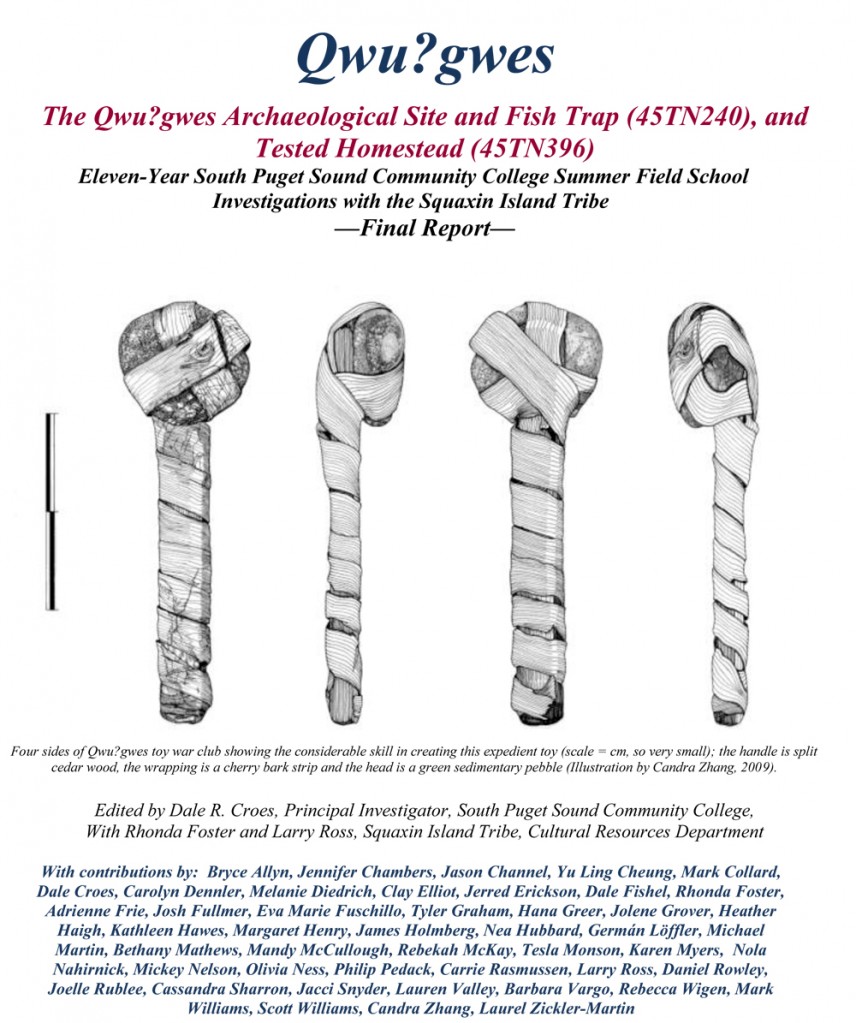
Qwu?gwes Archaeological Wet Site Final Report

This final Qwu?gwes wet site report has been accepted by the Washington State Department of Archaeology and Historic Preservation–if you would like to download a pdf go to:  Qwu?gwes Final Report with data Appendices
OR a two column version (1/2 size) with out the data Appendices:  Qwu?gwes Final Report in 2-column Polished Format
Qwu?gwes (45TN240) is located on Mud Bay at the southern end of Eld Inlet, Puget Sound, near Olympia, Washington. The site was named Qwu?gwes, a term in the indigenous Lushootseed language meaning a place to come together, share, and gather by the Squaxin Island Tribe in 2000 (Foster and Croes 2002). It describes a place where academic scientists and students and the cultural experts from the Squaxin Island Tribe strove to work in a cooperative partnership to better describe and explain the ancient history of this location. The ancient people and villages of this inlet were known as the “Squi-Aitl.”
The site consists of an area above the beach where food resources were processed, an intertidal shell midden, and an area where those gathering and processing would have temporarily lived. Also present nearby is a fish trap complex at the end of Orr Cove, northeast of the Qwu?gwes shell-midden (both considered 45TN240) and a homestead area to the southeast of Qwu?gwes that is associated with the original Donation Land Claim (45TN396).
Qwu?gwes is archaeologically significant because it (1) is the first substantial excavation of a site in all of south Puget Sound, (2) includes a waterlogged preserved section containing examples of wood and fiber artifacts in a major resource camp, and (3) contains a distinct record of shellfish and fisheries used at this camp.
From the beginning, the research and analyses for this multi-year field school project have been approached from two, equally important perspectives: (a) the scientific descriptive analyses and (b) the cultural explanatory analyses, both involving tribal representatives and archaeologists following the goal of an equal partnership through the 11+ years. These views are often complementary and provide a more comprehensive overview and place from which to offer joint interpretations of the ancient history of Qwu?gwes. The Qwu?gwes project has always been an educational training effort, not just a rescue excavation. Less than 35 cubic meters (2.3%) of the site have been excavated during the past 11 summer seasons of investigation. The 55, 1×1 meter units excavated by 2009 clearly revealed examples of three use areas: (1) a temporary habitation area, (2), a shellfish and other foods processing area, and (3) an inter-tidal waterlogged discard shell-midden area on the beach. These three distinct use areas serve as the focus of comparison for the data sets summarized here.

Ozette Village Basketry Dissertation Digitized

I have scanned illustrations (example here), re-made graphs, scanned computer generated maps, and digitized text for the Ozette Village wet site basketry analysis of 1977.  Since only poor copies of this work are in circulation, I wanted to make a better copy available for future wet site basketry research (though still a low resolution copy and in two parts because of its size):   ANCIENT BASKETRY ATTRIBUTES AND TYPES–CROES 1977 DISSERTATION Part I ;  OZETTE VILLAGE BASKETRY FUNCTIONAL CLASSIFICATION AND CONCLUSIONS–CROES 1977 DISSERTATION Part II

I have also posted here a Useful Wet Site Research References reflecting ancient basketry research that has been conducted since 1977: Useful References for Wet Site Basketry Research and Reports since 1977 Ozette Dissertation

The patterns of inter-site comparisons in 1977 seem to be holding up–and the new data uncovered seems to only bolster these general patterns (even cladistic analyses).  Hope this is helpful to researchers–do let me know references I undoubtedly left out.  Thanks, Dale Croes

NEW WETLAND BOOK! Wetland Archaeology and Beyond, Theory and Practice

Just Published!  Wetland Archaeology and Beyond, Theory and Practice 

By Francesco Menotti

Date: 2012–Publisher: Oxford University Press

ISBN: 978-0-19-957101-7

To order the book click HERE 

 Wetland Archaeology and Beyond takes the reader through the fascinating biography of wetland archaeology, from the dawn of the discipline to its remarkable achievements. Through a discussion of a large variety of worldwide wetland archaeological sites and their material culture, Menotti offers an appreciative study of the people who occupied these sites and who created the archaeological artefacts. The volume also includes a comprehensive explanation of the procedures and research processes involved in archaeological practice and theory.

Focusing on the relationship between archaeological experts and the general public, Menotti highlights the importance of this relationship for the future of the discipline as wetland ecosystems continue to disappear at an inexorable rate – and with them our invaluable cultural heritage.  TABLE OF CONTENTS:

List of Figures
Listof Maps
List of Tables
Dating Abbreviations
1: Wetland archaeology inside out
2: People-wetlands interactions through space and time
3: Living in and between the wetlands: resource potential and adaptability
4: Abundant well-preserved evidence
5: In the field and beyond: survey, excavation, preservation and conservation
6: Joint effort: a multidisciplinary scientific network
7: True or false? Learning via experiments
8: Wetland archaeology in a wider context
9: Being aware of and protecting wetland cultural heritage
Epilogue
Glossary
Maps
References
Index

About the Author, and European Coordinator for NewsWARP:

Francesco Menotti, Professor of Archaology, Institute of Prehistory and Archaeological Science, Basel University.

 Francesco Menotti is Professor of Archaeology at the Institute of Prehistory and Archaeological Science, at Basel University, Switzerland. He has been involved in wetland archaeological research for some fifteen years, working on various projects in different parts of Europe. His publications include ‘The missing period': Middle Bronze Age lake-dwellings in the Alps (2001) and Living on the lake in prehistoric Europe (ed.) (2004).


NEW: Die prähistorischen Feuchtbodensiedlungen am Südrand des Pfäffikersees

By Kurt Altorfer

Die prähistorischen Feuchtbodensiedlungen am Südrand des Pfäffikersees: Eine archäologische Bestandesaufnahme der Stationen Wetzikon-Robenhausen und Wetzikon-Himmerich

Publisher: Baudirektion Kanton Zürich

ISBN: 978-3-905681-59-8

For more information email the author at: kurt.altorfer@bd.zh.ch

The book shows how a combination of archive research and recently carried out excavations could lead to significant results!

To order the book click HERE: die-prahistorischen-feuchtbodensiedlungen-am-sudrand-des-pfaffikersees[1]

 Read the review in the European Journal of Archaeology 14(1-2): 301-303